

Recently, Qingdao Haiyuehui Technology Co., Ltd. unveiled the industry's first "Intelligent Aeromagnetic Real-Time Acquisition Software - Hongyan Changfei 2.0 Version." With its exceptional capabilities, it has become a powerful tool in the field of aeromagnetic exploration, bringing unprecedented convenience and efficiency to related operations.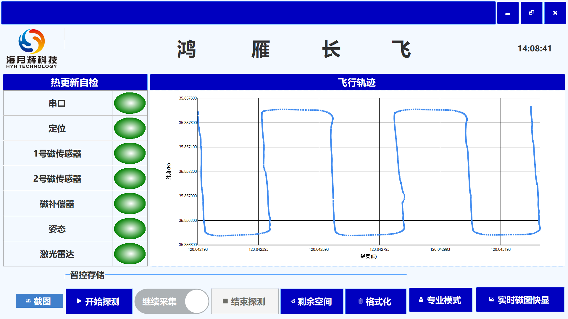
Figure 1. Hongyan Changfei Aeromagnetic Real-Time Acquisition Software Version 2.0
The Hongyan Changfei Real-Time Acquisition Software achieves real-time processing and visualization of aeromagnetic data through the real-time collection and transmission of data resources, as well as the control and management of real-time data. Leveraging advanced algorithms such as magnetic anomaly feature band-pass optimization filtering and attitude compensation, the software ensures precise and efficient data handling. Its highly intelligent human-computer interaction simplifies operational procedures and optimizes interface design, significantly reducing the learning curve and operational barriers for users. This, in turn, effectively enhances work efficiency and user experience.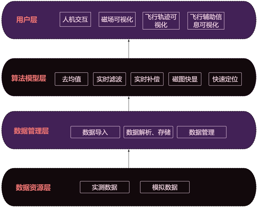 Figure 2. Block Diagram of Hongyan Changfei Aeromagnetic Real-Time Acquisition Program.
Hot Update Self-Check: The software is equipped with the capability to perform hot update self-checks on hardware, enabling real-time monitoring of the operational status of various sensors on the drone's hardware. Once the hardware stabilizes, the system proceeds with the detection tasks.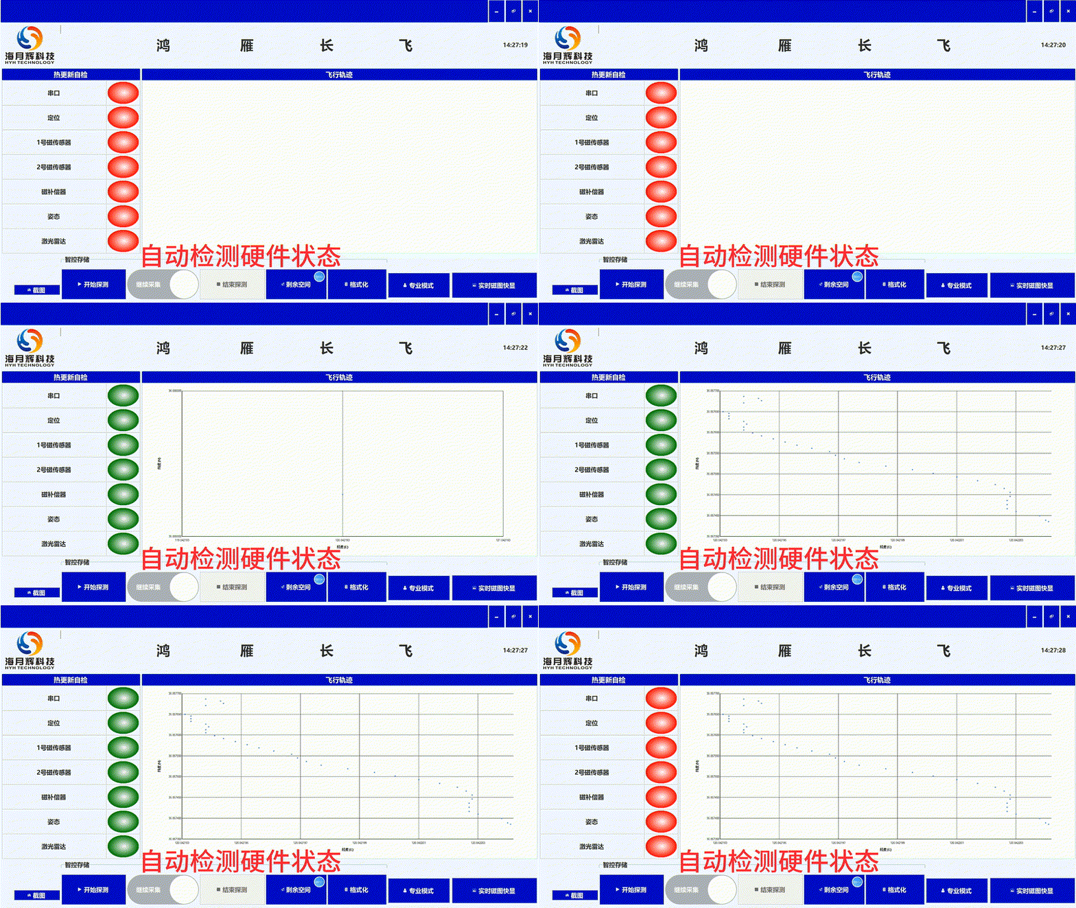
Intelligent Storage Control: The software is endowed with the capability for intelligent storage management. Utilizing advanced communication technologies, it not only receives aeromagnetic data collected by the drone's payload in real-time but also issues commands to the drone's payload. This intelligent control allows for the initiation/cessation of data saving, the querying of remaining storage capacity on the drone's payload, and the formatting of the storage space on the drone's payload. Figure 3. Intelligent Storage Control
Sampling Rate Customization: The software allows users to send commands to the drone's payload to adjust its sampling rate. It provides selectable sampling rate options, as well as the ability to input custom values to modify the sampling rate.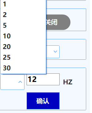 Figure 4. Sampling Rate Customization
Real-Time Filtering: The software is equipped with a powerful algorithm for real-time magnetic anomaly feature band-pass optimization filtering. Once the drone's flight speed is determined and the distance between the drone's payload and the buried objects underground is estimated, this algorithm can be activated. This feature processes the raw data received from the payload in real-time, effectively removing noise interference and enhancing data quality. It allows users to gain a more intuitive understanding of the magnetic anomaly characteristics during the aeromagnetic detection process.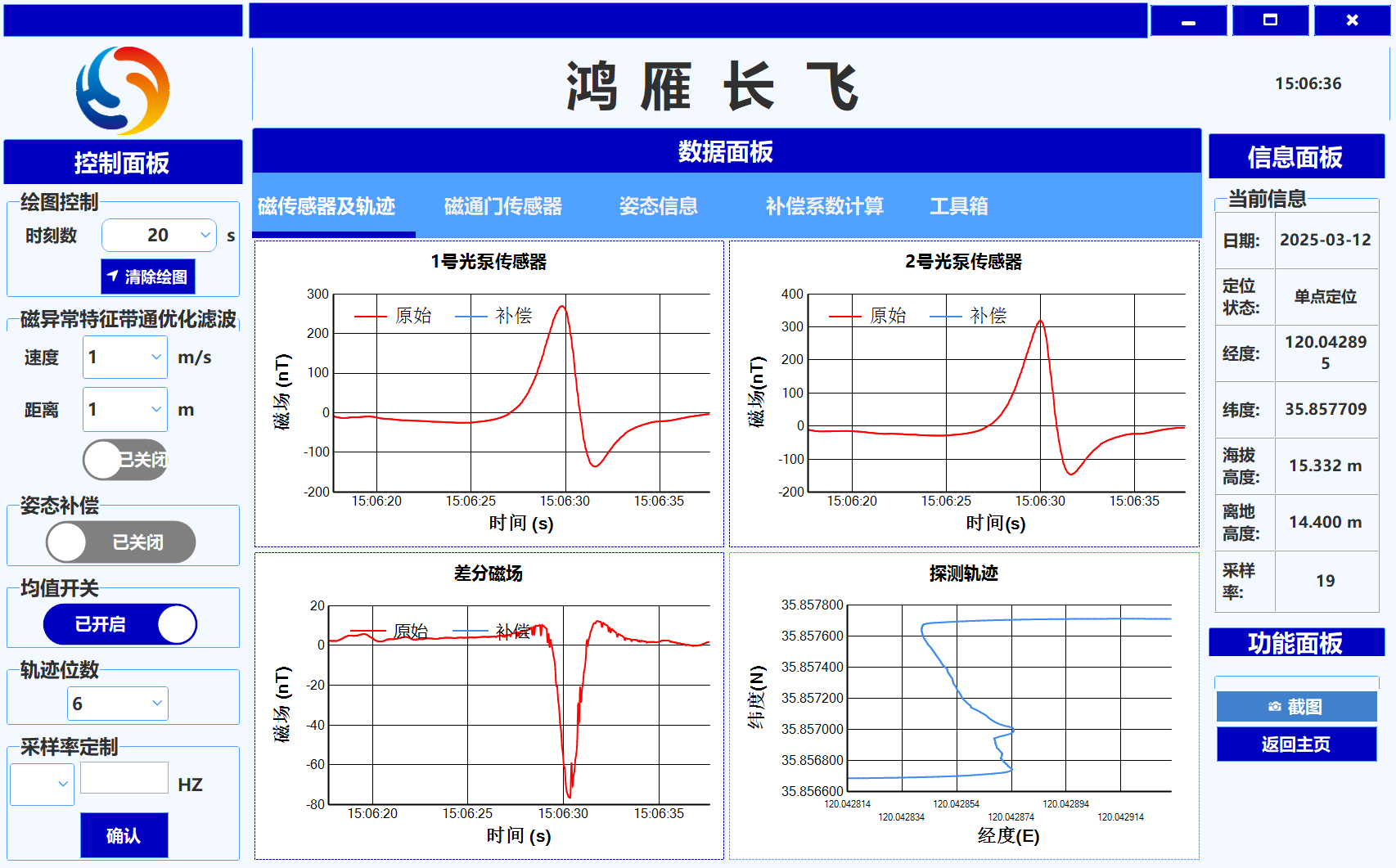 Figure 5. Real-Time Filtering
Real-Time Compensation: The software possesses the capability for real-time attitude compensation of data. Through a robust compensation algorithm, it can calculate compensation coefficients in real-time and apply real-time correction to the raw data received from the payload, thereby eliminating noise interference and enhancing the quality of visualized data. Whether in complex geological environments or during rapid flight movements, it can accurately capture subtle changes in magnetic field signals. This efficient real-time data processing capability provides a solid foundation for subsequent data analysis and processing.
Real-Time Magnetic Map Quick Display: The software is equipped with powerful imaging and inversion capabilities. It can rapidly generate intuitive magnetic field images based on the collected aeromagnetic data, allowing users to clearly visualize the distribution of the magnetic field. Utilizing advanced inversion algorithms, the software can also conduct in-depth analysis of the magnetic field data, inferring the precise locations of underground buried objects, such as unexploded ordnance, and the distribution of underground mineral resources. This feature provides crucial technical support for geological exploration and mineral resource development, enabling users to gain a more accurate understanding of subsurface conditions and enhancing exploration efficiency and accuracy.
The Hongyan Changfei Aeromagnetic Real-Time Acquisition Software can be widely applied in various scenarios such as underground/underwater buried unexploded ordnance detection, mineral exploration, and cultural relics/shipwreck salvage, providing precise data support for aeromagnetic detection and resource exploration. With the continuous advancement of technology and the expansion of application scenarios, it is poised to play a significant role in even more fields. We look forward to collaborating with more industry partners to explore further application possibilities of the software, promote the in-depth application of aeromagnetic detection technology across various sectors, and contribute more to the advancement of the industry.